
💡 Tip: This hiking guide is optimized for printing. Take it with you on your island adventure!
🥾 Lamma Island Hiking Trails Map 2025
Complete Guide to Island Walking Routes & Nature Trails
🗺️ Trail Overview
Lamma Island offers some of Hong Kong's most accessible hiking with stunning coastal views, traditional villages, and diverse landscapes. All trails are well-marked and suitable for various fitness levels.
Main Trail Length
Average Duration
Max Elevation
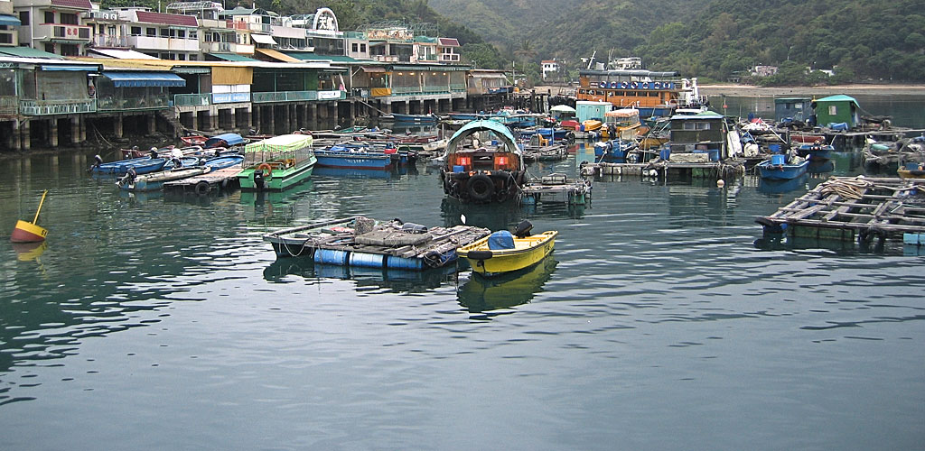
🌊 Main Island Trail (Yung Shue Wan ↔ Sok Kwu Wan)
MODERATERoute: Yung Shue Wan → Wind Power Station → Sok Kwu Wan
Highlights: Panoramic harbor views, wind turbines, traditional villages, seafood restaurants
Best For: First-time visitors, photography, village-to-village walking
Key Waypoints:
- Start: Yung Shue Wan Pier (0km)
- Hung Shing Ye Beach: 10-minute detour for swimming
- Wind Power Station: 2.2km - Photo stop and views
- Pavilion Viewpoint: 3.5km - Rest area with harbor panorama
- Finish: Sok Kwu Wan Pier (4.5km)
🏖️ Family Trail (Yung Shue Wan → Hung Shing Ye Beach)
EASYRoute: Yung Shue Wan → Beach via village path
Highlights: Sandy beach, swimming, cafes, easy walking
Best For: Families with children, beach days, short walks
Beach Facilities:
- Changing rooms and showers
- Beach cafes and restaurants
- Lifeguard service (summer season)
- Barbecue pits (booking required)
💨 Power Station Trail (Circular Route)
MODERATERoute: Yung Shue Wan → Power Station → Loop back
Highlights: Wind turbines, coastal views, less crowded paths
Best For: Photography, shorter hikes, avoiding crowds
Photo Opportunities:
- Wind turbines with city skyline backdrop
- Coastal rock formations
- Traditional village architecture
- Sunset views (evening hikes)
🕳️ Kamikaze Caves Trail
CHALLENGINGRoute: Sok Kwu Wan → Mountain path → Cave system
Highlights: WWII historical sites, panoramic views, adventure hiking
Best For: History enthusiasts, experienced hikers, adventure seekers
⚠️ Safety Warning
Cave areas can be dangerous: Use flashlights, watch for loose rocks, tell someone your plans. Some tunnels are unstable - do not enter without proper equipment and experience.
📍 Trail Map Reference
🔵 Main Trail (4.5km)
🟢 Family Trail (1.2km)
🟡 Power Station (3.2km)
🔴 Caves Trail (2.8km)
🚢 Ferry Piers
🏖️ Beaches
Download Interactive Map
For detailed GPS coordinates and
real-time navigation assistance
🛡️ Hiking Safety & Preparation
Essential Items:
- Water (1-2 liters per person)
- Sun protection (hat, sunscreen)
- Comfortable walking shoes
- Mobile phone (emergency contacts)
- Light snacks or lunch
- First aid basics
Weather Considerations:
- Check typhoon warnings before hiking
- Avoid trails during heavy rain
- Summer: Start early to avoid heat
- Winter: Trails less crowded but shorter daylight
- Best seasons: Oct-Dec, Feb-April
🚌 Transportation & Logistics
Getting There:
- Central to Yung Shue Wan: 20-30 min ferry (most frequent)
- Central to Sok Kwu Wan: 30-40 min ferry (less frequent)
- Aberdeen Alternative: Budget option to Mo Tat Wan
Trail Timing:
- Morning Start: 9:00-10:00 AM (avoid crowds, good weather)
- Ferry Planning: Check return times before starting
- Food Stops: Restaurants at both Yung Shue Wan and Sok Kwu Wan
- Emergency: Walk between villages if you miss last ferry
Recommended Itineraries:
| Time Available | Recommended Route | Highlights |
|---|---|---|
| 2-3 hours | Family Trail + Beach | Swimming, easy walk, family-friendly |
| 4-5 hours | Full Main Trail + Dinner | Complete island, seafood meal |
| 6+ hours | All trails + exploration | Full adventure, caves, photography |